|
15th |
WIGRY NATIONAL PARK
|
|||||||
|
of "WIGRY"
|
Zdzisław Szkiruć
Protection of landscape in the Wigry National Park
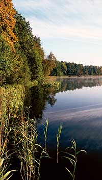
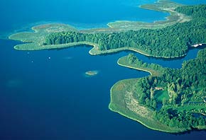
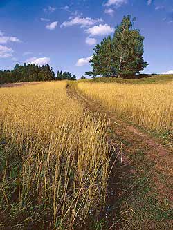
The landscape of the Wigry National Park is characterised by a mosaic layout of forest, water, peatbog and farm land natural ecosystems. In the Park there are lakes with complex shoreline, gentle hills, minor rivers and streams, peatbogs and plains. The land in the Park is covered with a compact complex of a coniferous forest and stolons of farmland.
121 separate landscape units have been identified within the vegetation microlandscapes. In “The impact statement on conservation of resources and landscape values of the WNP” coming from the years 1996-1999, modes of action aiming at preservation or raising values of the units were defined in relation to each unit. The conservation of landscape values around Lake Wigry had begun thirty years earlier; in January of 1976 the Wigry Landscape Park was established. The beginnings of protection of the areas around Lake Wigry date back to the 1930s. Unfortunately, World War II and its consequences partly ruined the effects of those actions.
Such a mosaic of varied landscapes causes that the area of the Park has been classified among a few physical and geographical regions, and, according to the classifications worked out by professor Kondracki, it belongs to the macroregion of the Lithuanian Lake District. It is divided into two mesoregions: Eastern-Suwalki Lake District and Augustowska Plain. Moreover, in the Park the following microlandscapes, which differ in actual flora, have been identified: conditions for development of potential vegetation, plant dynamics, foreseen target condition, anthropogenic hazards for vegetation, and recreational and tourist usefulness.
The natural values of the Wigry National Park have been confirmed in official documents, i.e.:
The forests surrounding Lake Wigry first underwent man’s intensive pressure in the 17th and 18th centuries as a result of tree felling for charcoal burning, iron smelting, potash and birch tar making, etc. Changes in the extent of compact tree stands can be estimated when comparing historical maps. Along with the change in the forest extent there was a simplification of tree stands structure, which meant a decrease in the number of leafy species. Since the 19th century patterns of German forestry have been applied, which based forest management on coniferous species, particularly on the pine tree. Within 15 years of existence of the WNP works have been carried out to restore the natural species composition of tree stands, which is characteristic of these habitats.
Water ecosystems in the Park and its protection zone have undergone certain transformations. Field stolons, which are picturesquely embedded in the Park’s landscape, are an example of partial levelling of postglacial hills, which were much higher only half a century ago. The introduction of deep ploughing accelerated the erosion.
Uncontrolled development of these areas, valuable because of their landscape, is a separate problem. The process of ordering of the development in the shoreline zone is not easy. The protection of landscape values is not understood by clerks in local governments. The protection was guaranteed by plans for land management, which were rescinded by an Act of Parliament. The waiting time for new plans, which are supposed to be an instrument of landscape protection, among other things, is used by investors intending to implement projects which were impossible to carry out under the old plans.
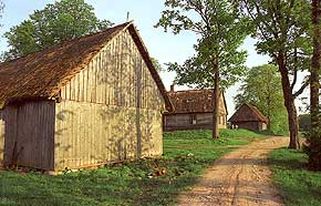
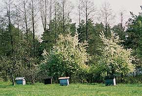
The landscape protection cannot be limited only to wooded areas and field stolons. Also the traditional village housing and historically formed rural systems should be preserved. It can be done in two ways: through preservation of the old function of a cubage base of a farmstead, and also through a change in function, and using these facilities for tourist and recreational needs.
|
|||||||
|
|
|